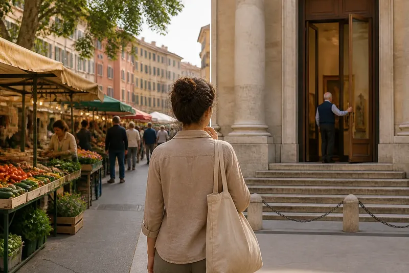
Why Old Streets Rarely Follow a Straight Line
Why old streets rarely follow a straight line: read slopes, bends, and building edges to see how a historic route records a city’s growth.
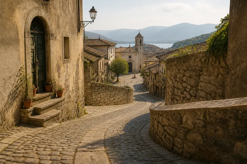
At the corner, a narrow lane slips downhill, bends around a stone wall, then opens onto a square. That turn is not just a picturesque detail. To understand why old streets rarely follow a straight line, look at what the route meets: a slope, an older path, a stream, or buildings that arrived one edge at a time.
Historic streets are often records of accumulated decisions rather than parts of a single master plan. A useful walk does not require a map of every period. It asks you to notice where the ground changes, where a path keeps going under a new name, and where a street seems to negotiate with the buildings beside it.
Start with the ground
Walk a street slowly enough to feel its gradient. A route may climb steadily, flatten at a landing, and turn where the ground offers an easier passage. On a contour map, streets that trace roughly the same elevation often run across a hillside; routes that cut sharply uphill may connect those bands.
Notice how the paving changes, too. A shallow gutter, steps at a side entrance, or a retaining wall can reveal where rainwater runs and where the slope has been held back. These details do not prove why a lane was laid out, but they help you read the practical conditions its builders faced.
At a steep corner, compare the street’s line with the building entrances. If doorways sit at different heights, the ground may have been reshaped in stages, or buildings may have adapted separately to a shared slope. The bend can be a compromise between a walkable grade and the available space.
Think of a street like a length of ribbon laid over a lumpy table: it follows the surface where it can, then folds around obstacles. The analogy is simple, but it helps separate the route’s response to terrain from the geometry of a modern plan.
Trace the older route
Some lanes preserve a path that served a purpose before the surrounding blocks took their current form. A track toward a river crossing, a gate, a well, a churchyard, or a hilltop may have attracted foot traffic long before a formal street connected the area to the rest of town.
Look for alignments rather than isolated curiosities. Stand where a lane bends and see whether its earlier direction seems to continue as a passage, a narrow courtyard opening, or a street beyond the next block. A route can disappear from view and reappear after a building or square interrupts it.
Names can offer another clue. Words such as “gate,” “bridge,” “mill,” or “market” may point toward an older destination, though a name alone cannot establish the street’s age or original use. Treat it as a prompt to look around, not as a verdict.
Where a historic center meets a river, ask how people could cross when water was high or a bridge was unavailable. A crooked approach may lead toward a crossing point chosen for the banks, while a second lane may connect to a landing or a route along the water. The street’s direction can make more sense once its destination is visible.
Read the building edges
Street walls often reflect parcels assembled and rebuilt over time. One frontage may sit close to the pavement while the next pulls back; an alley may narrow where property lines pinch together. The public route can inherit these edges instead of cutting through them to make a tidy shape.
Watch for small changes in alignment: a doorway turned toward the lane, a corner building set at an angle, or a short stretch where the pavement widens. Such shifts may mark an old boundary, an entrance to a larger property, or a later adjustment. They are clues to ask about, not proof of one particular history.
Building materials can help distinguish visible phases. A repaired stone wall, a newer brick infill, or a change in roofline may show that adjoining parts were altered at different times. Avoid assuming that an old-looking façade dates the street itself; the street, the frontage, and the current surface can have separate histories.
Pause at a bend and look back. A street that seems crooked from one direction may align with a church tower, a gate, or a bridge when seen from another. The change in view can reveal that the route links destinations even if it does not form a straight axis.
Notice where routes meet
Junctions are especially useful places to read a street pattern. A broad, irregular meeting point may have grown where several paths converged, while a neat intersection can reflect a later effort to organize movement. Compare the width, pavement, and building fronts on each approach before deciding which route seems older.
A small square can be an enlarged junction rather than a planned plaza. Look for streets entering at uneven angles, shopfronts facing more than one direction, or a narrow passage that continues behind the open space. These features suggest that movement shaped the square’s outline, though its present uses may be quite different.
In a port town, a lane may bend toward a quay or climb away from the water. In a walled settlement, a street may narrow near a former entrance. In a hillside neighborhood, a stair or stepped lane may connect streets that cannot meet at the same level. Each setting offers its own questions; avoid applying one city’s pattern as a universal explanation.
Say you are walking through an invented hillside town and find a lane that curves around a retaining wall before reaching a small church. Imagine checking the slope, then looking for a path that continues beyond the churchyard and a doorway aligned with the curve. The expected observable result is not a single confirmed story but a clearer set of possibilities: the route may respond to the hillside, connect an older approach, or follow a property edge.
Keep a field note
A few short observations can make a walk more revealing without turning it into a research project. Record what you can see and keep your explanation separate from the evidence.
- Mark the slope: Note where the route climbs, drops, or levels out; compare that change with the direction of the bends.
- Find the likely destination: Look toward a bridge, gate, water, ridge, or public building that the lane may connect.
- Follow the line: Check whether the route continues through a passage, courtyard entrance, or street beyond a square.
- Compare the frontages: Notice changes in setback, doorway direction, wall material, and the width of the pavement.
- Record the junction: Sketch which streets meet and whether their angles or widths differ.
- Separate clue from claim: Write “the lane bends beside a retaining wall” before writing “the wall caused the bend.”
A paper map can help you compare the street with the terrain, while a phone map can show how a route continues beyond the next block. Use either as a prompt, then check the ground directly. A map may simplify narrow passages or omit steps, and a modern street name may not match an older route.
Which clues matter most?
Can a bend reveal a street’s age?
A bend by itself cannot date a street. It becomes more informative when it aligns with an older route, follows the slope, or meets building edges that appear to preserve earlier boundaries.
Why do old streets narrow suddenly?
A narrowing may reflect a pinch between property lines, a former gate, or a passage that was never intended for broad traffic. Compare the walls and openings on both sides before assigning a cause.
How can I tell a hill street from a planned curve?
Check the gradient and look for retaining walls, steps, and changes in entrance height. If the curve continues on relatively level ground, terrain may be only part of the explanation.
Should I trust a street name as historical evidence?
Use it as a clue, not a complete account. Names can change, survive after their original meaning fades, or describe a destination rather than the route’s earliest purpose.
Let uncertainty guide the walk
Reading an old street is less about solving a puzzle than noticing what the route makes possible. A turn may bring a traveler around a slope, toward a crossing, or along a parcel boundary; several forces may have shaped the same stretch.
When asking why old streets rarely follow a straight line, start with what is visible: the grade underfoot, the direction beyond the bend, the shape of the junction, and the way buildings meet the pavement. Keep the observation precise and the explanation provisional. That habit leaves room for the street to tell a more complicated story than a neat line on a map.
Before leaving, walk the same corner from the opposite direction. A doorway that looked misplaced may now face the route, or a turn may frame the destination it was leading toward. That second view is often the most useful field note to carry on.